Hiking trails
Our hiking trails offer a unique opportunity to explore nature and enjoy fresh air, while also providing a sense of adventure and exercise. Whether you're an experienced hiker or a beginner, there are trails suitable for all levels and interests.
These marked paths take you through diverse terrain, from forests and mountains to coastlines and valleys, giving you the chance to discover scenic spots and experience the surrounding environment. The trails also offer historical and cultural richness as you pass by noteworthy sites.
No matter your goal with hiking, it's a fantastic activity that promotes health, adventure, and a connection to nature. So lace up your hiking boots and head out on an exciting journey on foot!
Signposts from Skatan road. Routes start at 3 km and up.
The hiking trail on Västerö runs through varied nature close to the sea with historical features.
From the trail, beautiful views of the Mickelsöarna and the open sea unfold.
You can hike in a varied archipelago landscape with ancient forests and sea bays.
On Västerö, you move through areas that played an important role for the Jäger movement.
At the rest stops, there are firewood and fire pits.
You can read more here
Map
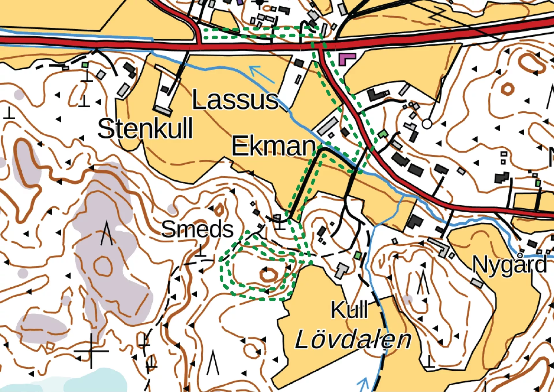
Andkil hiking trail consists of two sections—one that's 1.7 km and a longer route of nearly 9 km. The first part of the longer section involves climbing terrain, partly over cliffs and stones. It then continues through forests, fields, and open landscapes. The trail's highest point is a full 52 meters above sea level. Later in the trail, there are places marked with signs, where the names are written in dialect. The place names have arisen through old legends. Let your imagination run wild and invent the stories behind these names. Signs can direct you to the trail from Rejpeltvägen/Torrkullvägen heading toward Kondivorvägen.
Info: Andkil byaförening
Map
Signage from Kuckusvägen 1148. Routes 3 km and 5 km. Start at the ancient houses.
Take a trip to the beautiful nature of Vitmossen with reconstructed Stone and Bronze Age houses. Seize the opportunity to hike along the Bronze Age trail to the unique settlement with burial cairns.
This is one of the oldest discovered settlements in Finland and belongs to the early Bronze Age. Get acquainted with several clear house foundations or terraces from those times. During the Bronze Age, these ancient sites were located by an arm of the sea that extended all the way to the southern part of Vörå.
Map
Signage from Norrvalla, Vöråvägen 305-307. Routes range from 3 km to 7 km.
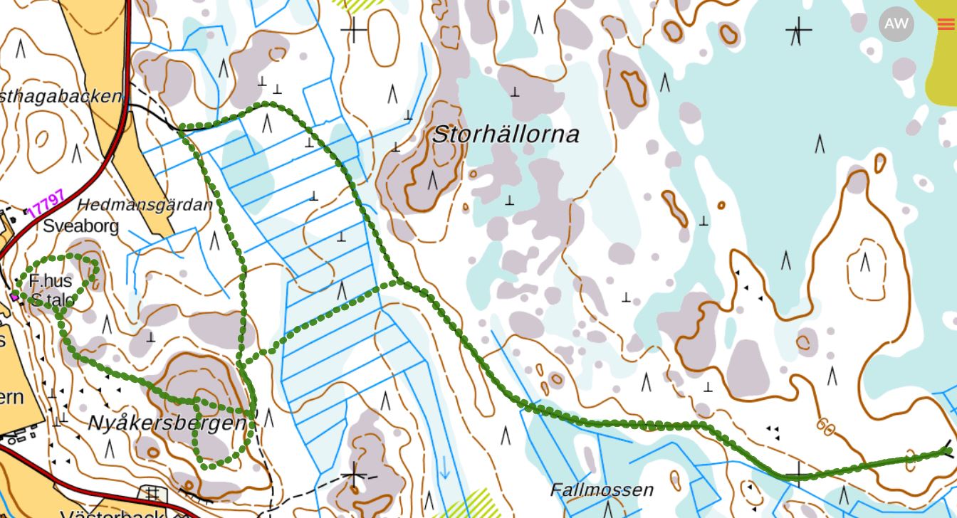
The connecting trail between Bobergsleden and Vitmossleden offers opportunities for long hikes, with distances exceeding 20 km round trip.
Shorter sections can also be hiked along the trail as it crosses several side roads along the forest road in Rökiö where you can start.
You'll experience diverse nature such as rocky outcrops, ancient mystical forests, bogs, and marshes, as well as ancient remains.
Info: phone 06-383 1012
Map Norrvalla-Boberget
Map Norrvalla-Boberget-Lasor-Vitmossen
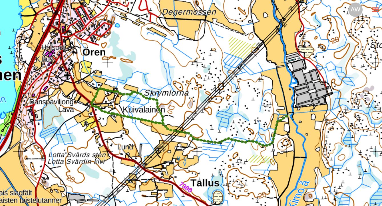
Start from Kimo Bruk, Bruksgatan 38. Parking is available by the road. The routes are 1.5 km, 3 km, and 8 km.
There are four rest areas with tables and benches. The 1.5 and 3 km routes are wide chip paths and are suitable for strollers, and with assistance, also for wheelchairs, depending on the weather and season. The 8 km route is partially a terrain trail.
Here you can find more information, a printable map, and an interactive map where you can visit the trail online.
A map and a more detailed brochure can be purchased at the Kimo Bruk Museum and Gallery and at Einars Café: Kimo Bruk
End your hike with a stroll through the beautiful industrial park and take a walk around the estate’s maiden dance/stone labyrinth.
Start: Signage from Lotlaxvägen.
Length: 3.5 km.
Halfway there is a rest area with picnic tables.
Info: Hembygdsföreningen Framstegsvännerna, phone 040-5304033. Map and info
Start and finish at Tottesund Manor, Tottesund 529. Length: 3.6 km.
Along the trail, there are tables and benches, as well as a barbecue hut at the far end of the trail.
Info: Maxmo hembygdsförening, phone 040-1896882.
Read more here
Map
Start from Keskis UF location, Brännarsvägen 730.
Route options: 1.7 km, 3.5 km, and approximately 6 km. Along the trail, there is a bench and a small barbecue area.
The trail partly follows the old illuminated ski track and a forest road.
Start: Haviståkersvägen 95, Vörå. The trails start behind the outbuilding at Arvidsgården.
Routes: Arvidsstigen 1.3 km, Vernersstigen 1.5 km
Suitable for everyone. Accessible with a stroller.
During the summer months, there are fairy tale characters and toy animals along the trails.
Map
Start: Brännarsvägen 200, Komossa.
The trail passes over beautiful rocky outcrops. The observation tower is located at one of the highest points in Ostrobothnia, 71 meters above sea level. Three trails: Hoppamäki 2.5 km, Auras 3.8 km, Haplund 4.8 km
Map
Start: Kimovägen 70, Oravais
Route options: 2 and 5 km
Along the trail, there are benches and tables.
Map
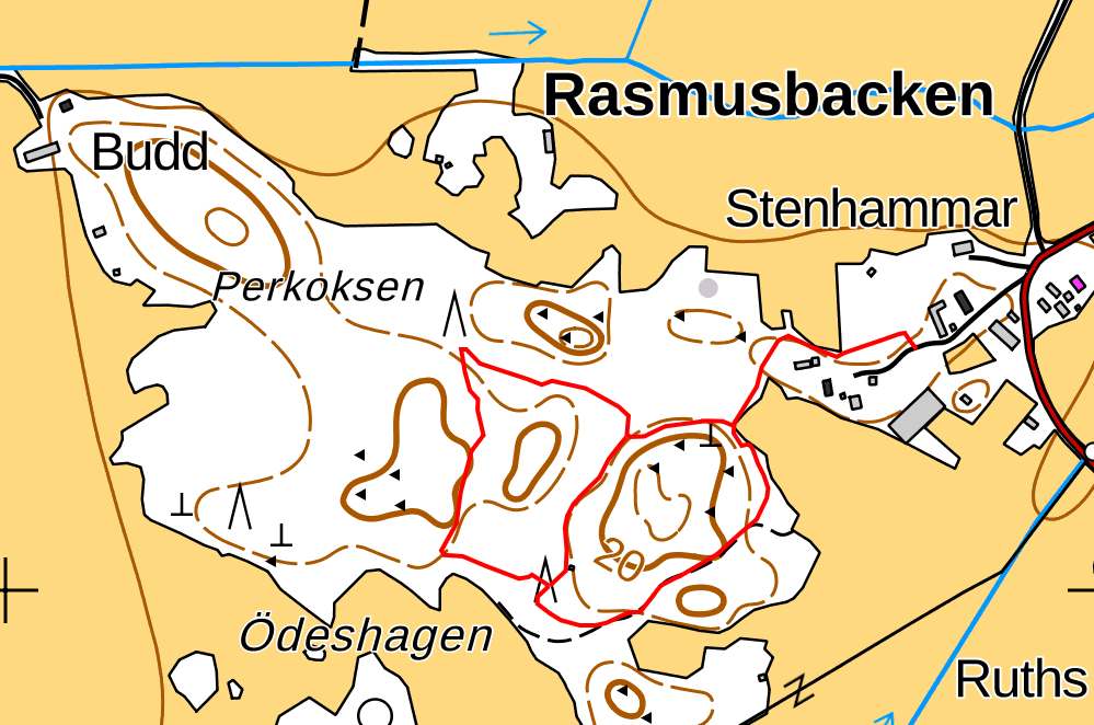
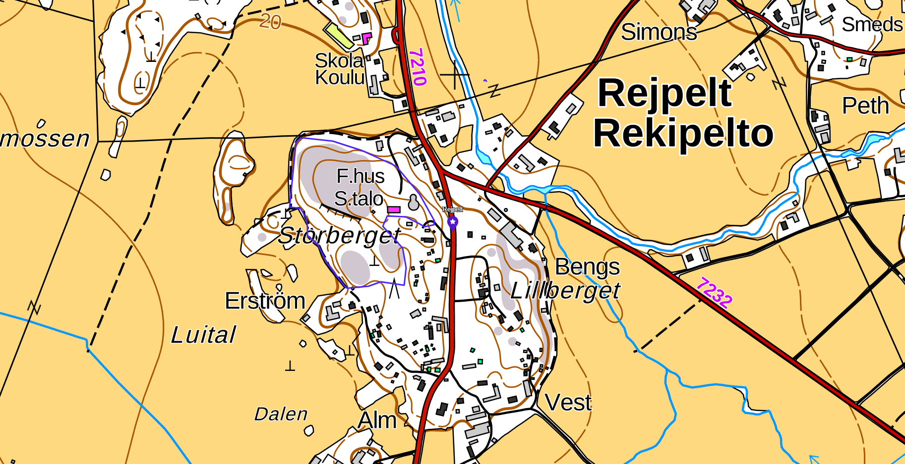
Start: Information board at Storberget, Rejpeltvägen 341
Length: 1.5 km
The scenic wide hiking trail circles Storberget with the local history museum Fädernegården, the dance pavilion, and the community house. Suitable for everyone. Also accessible with a stroller in the summer. Large parking area.
Tyrgärdback, or “Tyrjäälback,” is likely an ancient assembly and sacrificial site.
In addition to being the god of war, Tyr was also considered a cautious jurist who weighed matters fairly and granted justice in an appropriate way.
For this reason, it is believed that the place served as an ancient assembly site as far back as the 7th century. In order to quickly outcompete paganism, missionaries often managed to obtain permission to build a church right on the site of the old assembly.
Start: Signposted from Klemetsgårdarna’s parking area, Kärklaxvägen 308
Distance: approx. 2 km
Info: www.maxmo.sou.fi or tel: 0500 363 681
Start from Vörå ski center, Skidbacksvägen 16.
The trail runs through varied terrain with both ancient enchanted forests and steep rocky outcrops.
Length: 5–6.3 km.
Maintained by: Vörå IF
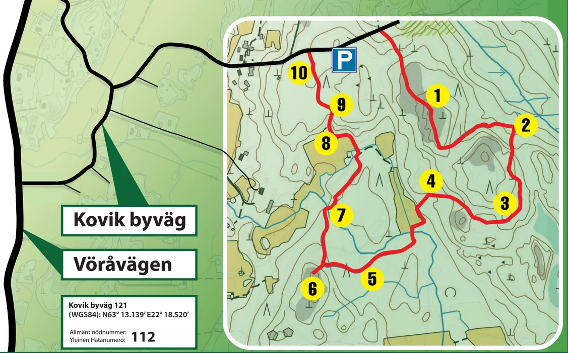
Start: Kovik byväg 121, signposted from Vöråvägen.
Length: 3 kilometers
The hiking trail winds through beautiful and hilly nature. Along the trail, ten historical sites are marked, each connected to memorable events, everyday life of the villagers, and colorful characters from the village’s past – welcome to enjoy a dose of local history! There are scenic natural rest spots along the way. Making fires is prohibited.
Maintained by: Kovik ungdoms- och nykterhetsförening rf